Supported Layers
Not all layers in a QGIS project will render in the Kumoy web map. Only layer types explicitly supported by Kumoy are displayed.
This page lists the supported layer types and important display considerations.
Supported Layers#
Kumoy's web map currently supports the following two types of layers.
Vector#
- Vectors saved in Kumoy can be displayed as layers in the web map.
- Vectors can cover other layers.
- Clicking a feature on the map lets you view its attribute information.
XYZ Tiles#
- Standard XYZ Tiles such as OpenStreetMap can be used as background maps.
- If a QGIS project contains XYZ Tiles layers, they will also be displayed as background maps in the web map.
- Terrain RGB / Terrarium elevation tiles are also supported for Hillshade (excluding coloring) and Singleband gray rendering.
TipElevation tiles configured in QGIS using the Terrain RGB / Terrarium format can also be used on the web map. This is useful for sharing terrain relief maps or elevation-based maps on the web. Rendering differences between QGIS and the Kumoy web map may cause slight variations in shadow intensity or grayscale tone.
NoteEven if XYZ Tiles are specified using
http, the web map requests them overhttps. Tiles not served overhttpsmay not be displayed.
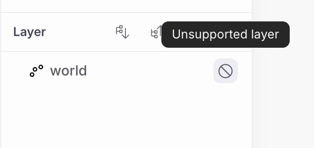
Unsupported Layers#
-
Only XYZ Tiles and Kumoy vectors are supported in the web map.
-
Locally stored data or any other layer type will not appear in the web map.
-
Unsupported layers are labeled Unsupported layer in the Layers panel.
Notes#
- Web map rendering reflects the QGIS project content saved in Kumoy.
- A layer visible in QGIS may not appear in the web map if its type is unsupported.
- Supported layer types and specifications may change in future updates.
Last update: Jul 21, 2026 07:40:43